

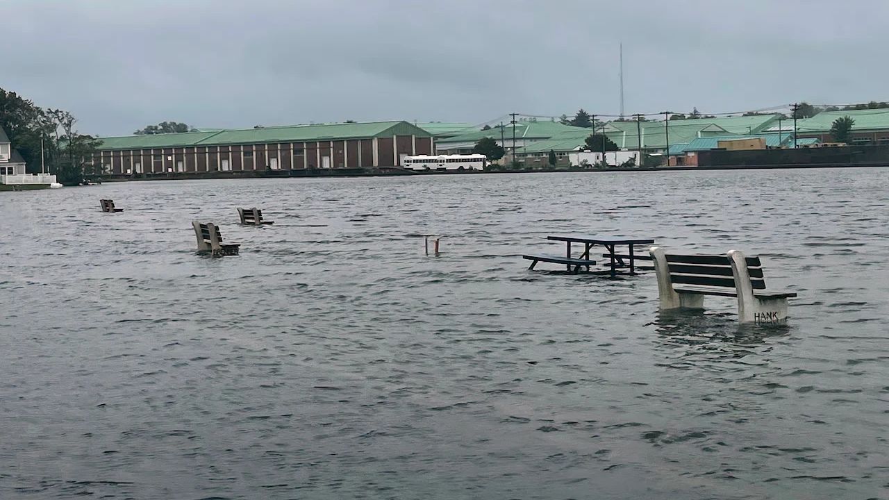
The powerful early-season nor’easter that battered the Tri-State Area over the weekend is weakening, but residents along the coast will still have to contend with rain, gusty winds and lingering tidal flooding through Monday.
The storm’s center is moving away from the region, yet its slow movement means the weather will not improve immediately. The National Weather Service said the system was expected to continue producing rain along the New York and New Jersey coast before gradually pulling away.
For parts of the New York City area and Long Island, coastal flooding remained a concern into Monday. A Coastal Flood Advisory was in effect for vulnerable shoreline locations, with the National Weather Service warning of minor flooding around waterfront areas. In some locations, the advisory extended into Monday afternoon.
Rain and wind continue before conditions improve
Monday will begin on a wet and breezy note across much of the region. Around New York City and Long Island, rain is expected mainly during the morning, with temperatures remaining in the mid-60s. Northeast winds will remain noticeable before shifting and weakening later in the day.
The storm has already produced a prolonged period of strong winds and coastal impacts. Earlier forecasts from the National Weather Service highlighted the potential for coastal flooding, heavy rain, strong wind gusts, beach erosion and dangerous marine conditions across the Northeast.
Because the storm moved slowly, the main concern was not simply how much rain fell at one time. Water levels along the coast had little opportunity to recover between high-tide cycles, increasing the potential for flooding in low-lying waterfront communities.
The Weather Prediction Center also noted that the combination of the storm’s strength, slow movement and a full moon contributed to heightened coastal flooding concerns during the weekend.
Coastal flooding remains a concern
The strongest coastal impacts are beginning to ease, but some locations can still experience minor flooding during the remaining high-tide cycles.
In the New York City area, the National Weather Service said vulnerable waterfront locations could see around a foot or less of inundation, with brief minor flooding possible. Residents are being advised not to drive through flooded roadways.
Parts of coastal New Jersey also experienced significant flooding during the storm. Earlier National Weather Service forecasts called for two to three feet of inundation in some low-lying coastal areas, along with large surf and dangerous rip currents.
The coastal flooding threat is expected to diminish as the storm pulls farther away.
A much quieter weather pattern follows
The biggest change will come after Monday.
The latest forecast calls for mostly sunny conditions and temperatures near 70 degrees on Tuesday around New York City and Long Island. Temperatures should then gradually climb through the middle and latter part of the week, with highs generally reaching the 70s and potentially around 80 degrees in parts of New Jersey.
That means the region is heading from a stormy, chilly start to the week toward a noticeably calmer stretch of weather.
For now, however, residents near the coast should continue to watch local weather and tide information through Monday, particularly in areas that are prone to flooding. The worst of the nor’easter has passed, but its effects will take a little longer to fully clear.
