

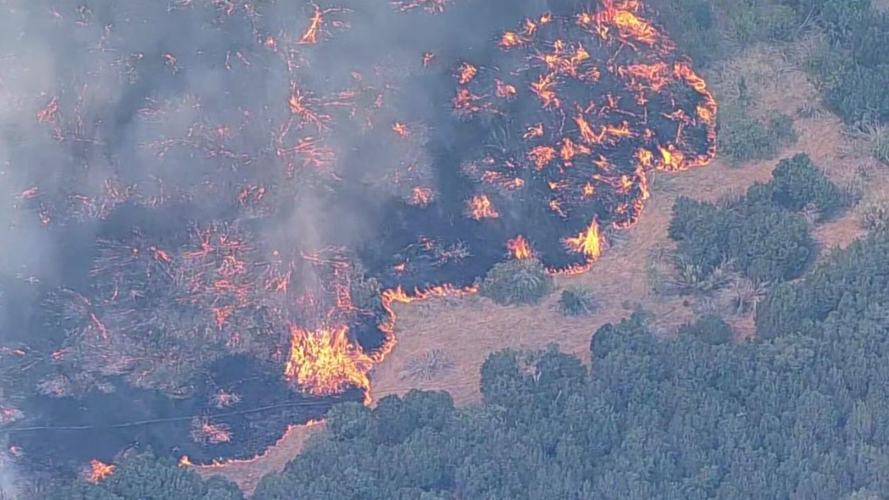
A fast-moving wildfire near Ross in Palo Pinto County has grown to at least 50,000 acres, spreading across parts of Palo Pinto and Jack counties and prompting evacuations, road closures and school disruptions.
The Ross Fire began Monday afternoon near Ross and expanded rapidly from an initial estimate of about 25 acres. By Tuesday night, the Texas A&M Forest Service reported the fire at 12% containment. Earlier Tuesday, officials had reported containment at 8%, highlighting how quickly conditions and firefighting progress were changing.
The fire is burning in the area of U.S. Highway 180 and FM 919. Officials have reported damage to several structures, while additional properties remain threatened. The blaze has also caused significant damage at Worth Ranch, a longtime Scouting property in Palo Pinto County.
The Longhorn Council of Scouting America said multiple buildings at Worth Ranch were destroyed or suffered major damage. No scouts, campers or guests were at the property when the fire reached the area, and camp ranger Pat Adams was safely evacuated.
Evacuations Ordered in Jack County
Residents along County Road 2210 toward Highway 281 in Jack County have been ordered to leave as the fire continues moving through the area.
The National Weather Service, relaying information from Jack County emergency management, said Farm to Market Road 4 was shut down because of the wildfire. Residents were directed to use County Road 2210 toward Highway 281 and were warned not to travel west toward FM 4.
An evacuation center has been established at Twin Lakes Recreation Center on Highway 59 in Jacksboro for people displaced by the fire. Officials have also urged residents to stay out of smoke-filled areas and keep routes clear for emergency crews.
Schools Adjust Schedules
The wildfire has also disrupted school operations in the area.
Jacksboro Independent School District delayed the start of classes by two hours Tuesday, while Perrin Consolidated Independent School District canceled classes for the day because of conditions associated with the fire.
Highway 180 Closed
U.S. Highway 180 has been closed between South FM 4 and FM 919 because of the fire.
A temporary flight restriction has also been established over the fire area as aircraft assist ground crews with the response.
Firefighting operations include support from the Texas Intrastate Fire Mutual Aid System strike team and the Texas A&M Forest Service. Dozers and aircraft are being used as crews work to contain the expanding grass fire.
Livestock and Pets Being Relocated
The wildfire has forced ranchers to move livestock from areas threatened by the flames.
The Graham Livestock Commission has offered temporary space for displaced livestock at the Old Mineral Wells Sale Barn on North Oak Avenue in Mineral Wells. The facility is intended to provide a holding location while owners arrange longer-term accommodations.
Animal shelters are also preparing for pets displaced by the fire. The Humane Society of North Texas said it was assisting the Mineral Wells Animal Shelter by moving animals out of its current population to make room for incoming pets. Twelve dogs and 26 cats were expected to be transferred to Fort Worth.
Dry Conditions Increase Fire Danger
Weather and fuel conditions have contributed to the rapid spread of the Ross Fire.
North Texas has gone more than a month without measurable rainfall in the affected area, leaving fine vegetation exceptionally dry. Gusty winds have added to the difficulty of controlling grass fires, allowing flames to spread rapidly when conditions align.
The National Weather Service has been monitoring wildfire conditions west of Interstate 35, where dry fuels and strong winds have increased the threat.
The Ross Fire had initially been reported at only about 25 acres Monday afternoon before growing dramatically over the following hours. By Tuesday, the fire had become one of the largest active wildfires in the region.
Fire crews remain focused on slowing the fire’s spread while authorities continue managing evacuations and protecting communities, ranches and other structures in its path.
SOURCES USED:
- Texas A&M Forest Service
- National Weather Service Fort Worth
- Palo Pinto County Emergency Service District
- Longhorn Council of Scouting America
